
Stunning countryside with woodlands, heritage and historic architecture, landscapes with far-reaching views, await discovery on the doorstep of the Penistone Line.
Guided Walks
We are so lucky to have dedicated, passionate Guided Walks leaders who provide seasonal Walk Programmes from stations along and adjacent to the Penistone Line. They have a wealth of experience and knowledge of the wonderful countryside around the Penistone Line, and beyond. The walks are great for well-being, open to all, and free.
We publish the guided walks programme in our events calendar, which gives information on the trail, walk length, meeting arrangements, and train times. Please check our website calendar for last-minute alterations due to unforeseen circumstances before you head out. PLP free Guided Walks are fortnightly on a Saturday morning.
A few years ago, community volunteers helped Penistone Line Partnership walk and map station-to-station walks along the Penistone Line, and reproduce The Penistone Line Trail in leaflet and download form. Volunteers also mapped a circular route from Berry Brow station to Castle Hill and back. There is a map on the platform at Berry Brow Station.

A bit about our Community Walk Leaders
In 2025, PLP partnered with Oliver & Katie, who run Wired Coffee & Cake in Honley. They are passionate about community and love walking in the area. They run their own Wired Walks, advertised in their cafe and on their socials.
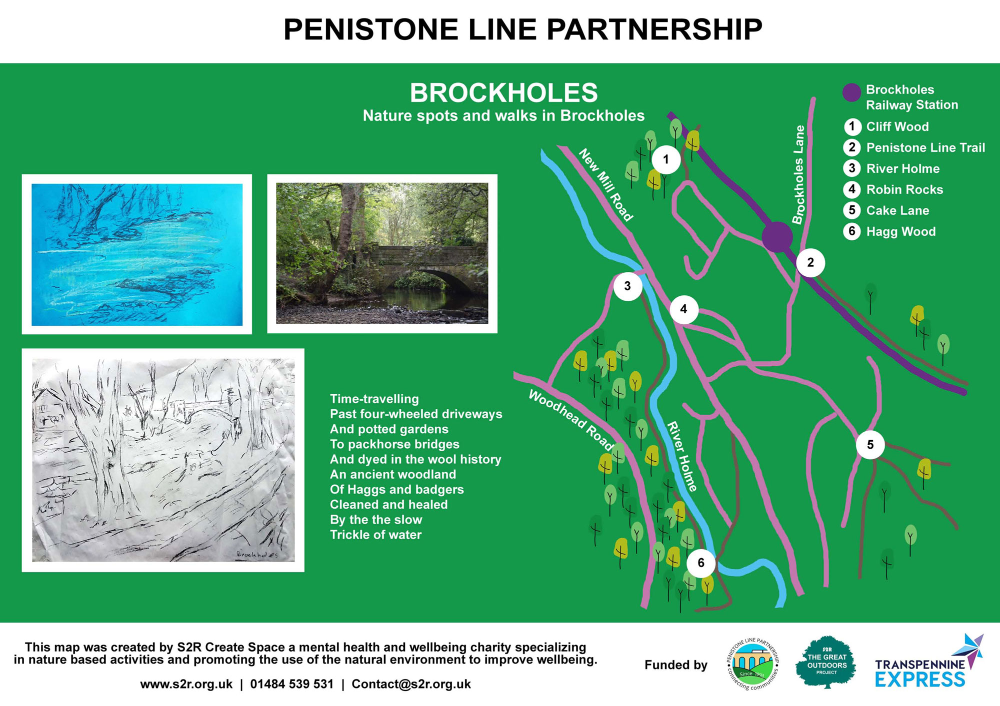
Paul from Brockholes Green Spaces & Station Adopters also helps with community walks and active travel mapping. PLP is fortunate to have excellent station adopters on the line. Brockholes Green Spaces & Station Adopters are a few stops on the line from Berry Brow. They are a group of volunteers passionate about biodiversity. They aim to improve the habitat value, secure funds, and campaign for improving the existing facilities within Brockholes Green Spaces and wildlife corridors.
With funding from Northern and Community Rail Network, Brockholes Green Spaces and Station Adopters are making a huge difference to Brockholes Station, with a vision of creating bee-friendly planting and a community herb planter. Heritage information, walking route maps, and wildlife identification information.
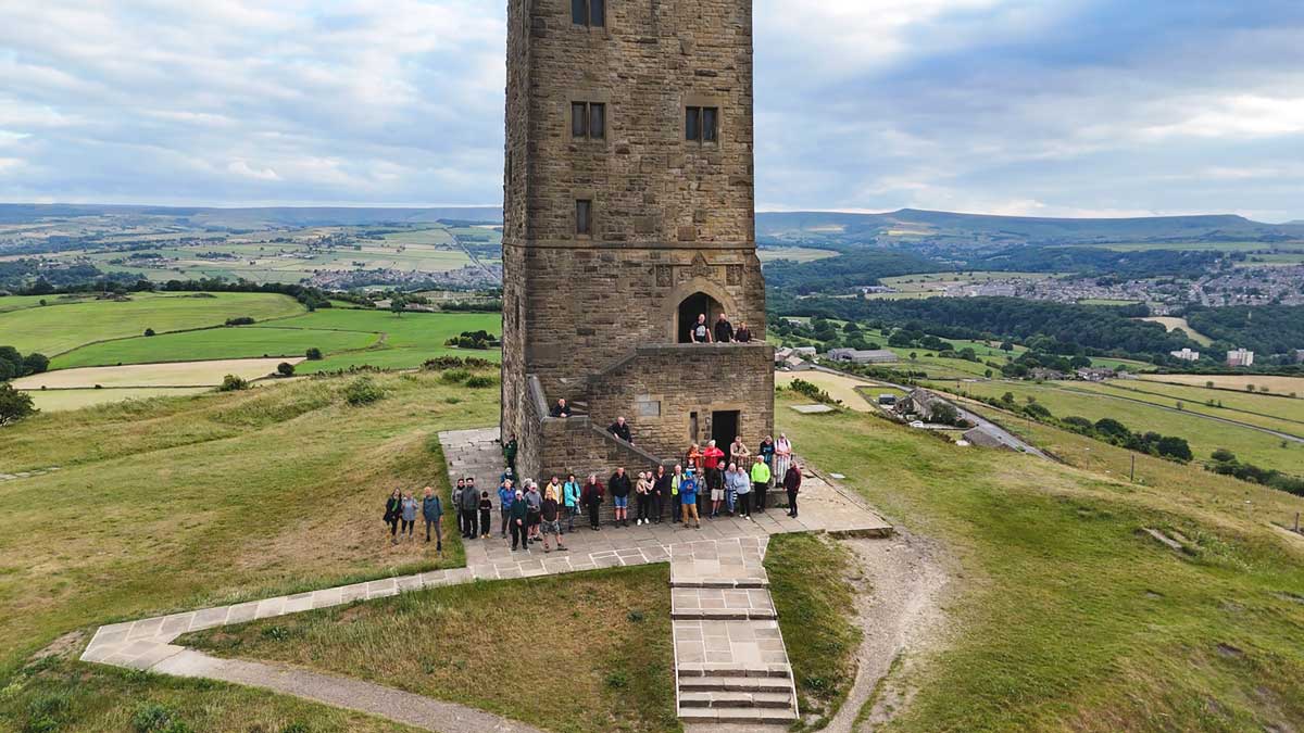
Drone footage on a windy June evening © Jordan Ellis. Berry Brow Station to Castle Hill Community Walk.
Walk with us again!
Drone footage on a windy June evening © Jordan Ellis. Berry Brow Station to Castle Hill Community Walk.

Self-Guided Walks
Denby Dale Walkers are Welcome have collaborated with local organisations to produce an ever-growing number of walks and trails to enjoy, which are accessible from the Penistone Line. We have installed their self-guided walks map at all the stations where a walking trail has been designed.
There are over 20 trails for all abilities that are accessible from the train stations along the line between Berry Brow and Dodworth.
Click the map below to visit Denby Dale Walkers are Welcome website where you can download or view each self-guided walk from the train and discover what our beautiful region has to offer.


Further Self-Guided Walks & Trails

See Huddersfield at its very best: grand listed buildings and small independent shops; a place for radicals from the Luddites to the Sex Pistols; the birthplace of the Rugby League; a town rich in creativity, stories, heritage and the odd ghostly encounter.
![]()
Discover Huddersfield have developed numerous trails to learn about the town’s history. Pick up a Trail Leaflet from public buildings or view online. There is also a web app for Huddersfield on Foot.
Experience the heritage of Huddersfield town centre with Discover Huddersfield Guided Walks Programme for which there is a small charge.

Walking in the Stocksbridge area
Stocksbridge Walkers are Welcome Group have at least 69 walks for all abilities. Walking between Stocksbridge and Penistone is aproximately 4.5 miles.
Head over to their website to discover the walks and trails on offer around the Stocksbridge area at stocksbridge-walkers.org.uk
CLICK IMAGE TO ENLARGE

Along the Line
At Berry Brow and Brockholes station, Penistone Line Partnership has installed mindful walk trails from the train. A project including poetry, photography, and mindful walking with S2R Support to Recovery. An independent mental health and wellbeing charity. The walks were developed by people accessing services at S2R.
Here are links to further walking and cycling trails near the Penistone Line. We welcome your suggestions for your favourite self-guided walks, so please send walks details to us at info@penline.co.uk.
Lockwood Spa Walk

Castle Hill Trail

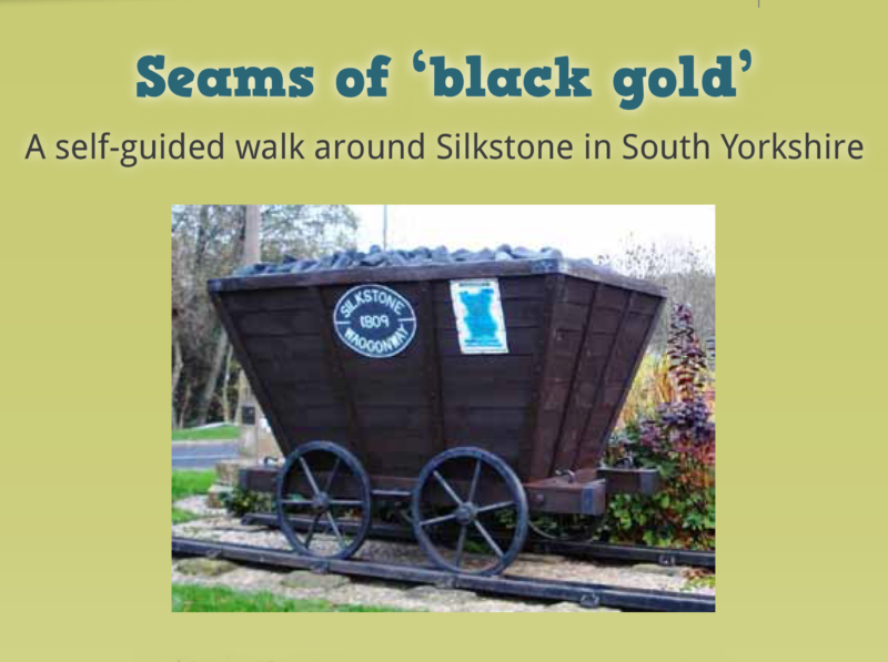
Silkstone Walk

Five Weirs Walk

The Trans Pennine Trail
 The Trans Pennine Trail caters for walkers, cyclists and horse riders and links the North and Irish seas. It forms part of the European walking route E8 and is part of the National Cycle Network as Route 62.
The trail is accessible for cyclists via Stocksmoor railway station from Station Road and then Shepley Road on Cyclist route 627.
From Shepley railway station for cyclists on Cyclist route 627 to Mill House Green and then east on the Trans Pennine Trail to Penistone.
There is nearby access to the Trans Pennine Trail from the following Penistone Line stations in South Yorkshire. Penistone, Silkstone Common, Barnsley, Wombwell, Elsecar, Chapeltown via Charlton Brook, Meadowhall, Sheffield (via Manor Lane a 1.5 mile walk).
Our Facebook Feed
